 The term “mobile application” is usually used to describe a piece of software designed to run on smartphones, tablets and other mobile devices. However a truly mobile app is one that is used while traveling and for travel and therefore typically utilizes a host of technologies such as GPS and Internet connectivity via Wi-Fi, 3G and/or 4G. But as many travelers that use mobile devices will attest, the availability of these technologies can be uncertain and even nonexistent at times.
Wi-Fi is usually limited to stationary locations such as restaurants, hotels or tourist centers. It is usually not an option when traveling by road or by foot in rural or wilderness areas. 3G and 4G data coverage has become widespread in recent years but can disappear when traveling underground, in mountainous terrain or too far from civilization. And even though GPS encircles the planet it too can be lost underground or even under dense foliage.
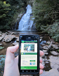
When Mobile Mind was presented with the opportunity to build the U.S. Forest Service’s first mobile application we had to take into consideration all of these communication limitations. While developing the Chattahoochee-Oconee National Forests (CONF) app we always kept in mind that it would eventually be depended upon by hundreds, and potentially thousands of travelers. They would use the app to locate and find their way to, and from, their favorite recreation sites and keep on top of the latest news and alerts issued by the U.S. Forest Service for their area. So ironically we built this most mobile of mobile applications to be as least dependent upon mobile communications and connectivity as possible.
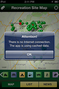
Caching maps is one of the first steps to ensure that a map-based mobile application like the CONF app will continue to function during intermittent Internet connectivity. This approach is not straightforward however as storage space and retrieval time has to be balanced with availability of underlying base maps when communications fail. We decided to hardcode the recreation site locations and details instead of streaming them to ensure that this information was always available to the user regardless of where they used the app. Changes to the recreation site information and photos are infrequent enough that they can be made through periodic updates to the app itself. As part of the detailed information for each recreation site we included the latitude and longitude coordinates for each site. This can be useful when having to use another GPS device with a better connection or even traditional paper maps to find a rec site. As a last line of defense for when all signal is lost we also included good old-fashioned written directions which anyone with an odometer and the ability to read street signs can use to get to their destination site.
Time critical information such as news, events and alerts are pulled from U.S. Forest Service web servers every time the app is started or the refresh button is touched. This information is stored on the device for display when there is no Internet connectivity so the user is not stuck viewing a blank screen. We also made sure the CONF app displays an alert when there is no Internet connection so the user immediately knows whether the app is running in online or offline mode.
The key to creating useful and functional travel apps is to realize and accept the limitations of modern telecommunications technology and to build fallbacks into the application so that it can continue to operate and assist the user regardless of connectivity. Even if these fallbacks utilize centuries old analog technology it is better than letting a hiker deep in the woods or a driver high on a mountain become lost or stranded. Many of us here at Mobile Mind love and enjoy our National Forests, but we would hate to be left staring at a blank screen when we’re left without a signal.

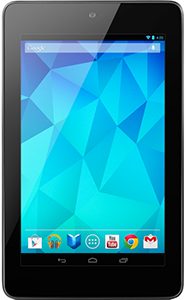
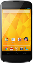 Google’s Nexus phones and tablets are currently hot sellers. All models feature Wi-Fi and Bluetooth but the Nexus 4 and some Nexus 7 models are also compatible with HSPA+ wireless networks. But what exactly is HSPA+? This question is not an uncommon one, particularly here in the United States where we are more familiar with its predecessor, 3G. HSPA+ stands for Evolved High-Speed Packet Access and is a wireless communications standard that enhances the data speed of 3G networks. In fact it is considered the pinnacle of speed for 3G networks.
 QR codes, those mainly white boxes full of little black squares, can be found everywhere. They have become almost ubiquitous to not only the IT landscape but the physical landscape around us. We here at Mobile Mind love QR codes (we even have them on our business cards) but we can understand if some people think they may becoming abused. There are certainly